Location: Riihimäki
Type: master plan, land-use planning, green infrastructure
Client: City of Riihimäki
Year: 2019-2020
Design: Landscape architecture Nomaji landscape architects Ltd
Collaborators: Arkkitehdit LSV, Jolma Architects, TUPA architecture, traffic Ramboll Ltd
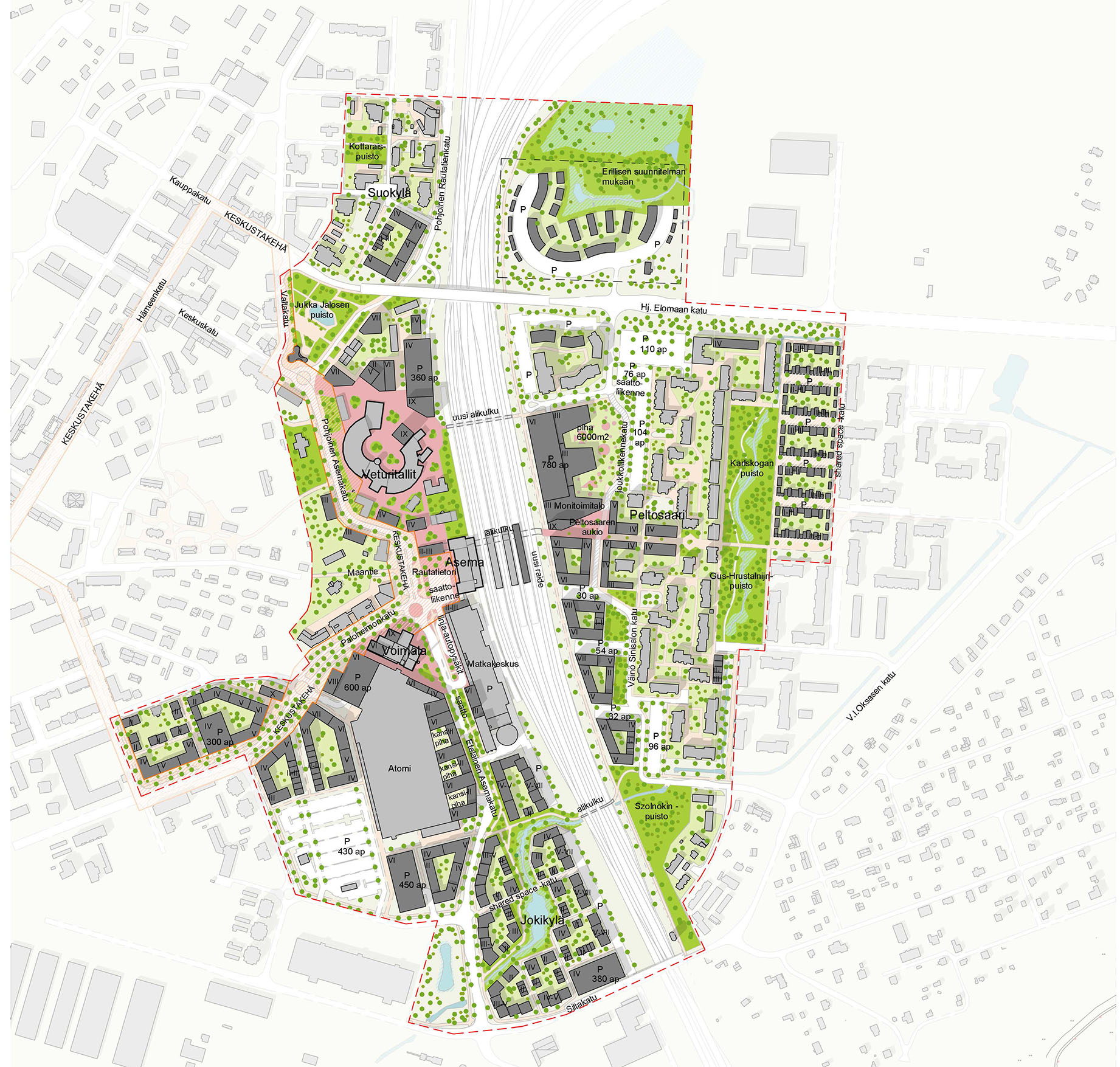
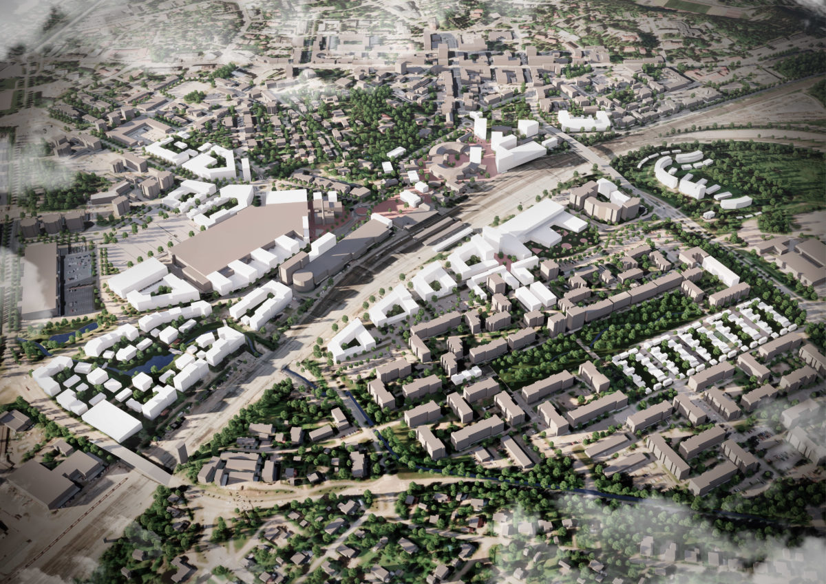
The Riihimäki Station Area Master Plan includes land use, traffic planning, and architectural master planning for an area of 80 hectares to accommodate 5 000 inhabitants.
The Master Plan for Riihimäki Station Area brings together disparate and detached neighborhoods separated by the bisecting railway line. The plan reconciles different socio-economic conditions to create a more egalitarian society in keeping with Finnish values. The master plan has been developed through an innovative design in dialogue process, consulting local communities, businesses, and individuals. During the design process extensive online and live public consultation helped inform and consolidate draft design options, integrating public, cultural and social needs into the fabric and program of the design. A visually clear, accessible impact assessment of the draft proposals formed an integral part of the decision-making process.
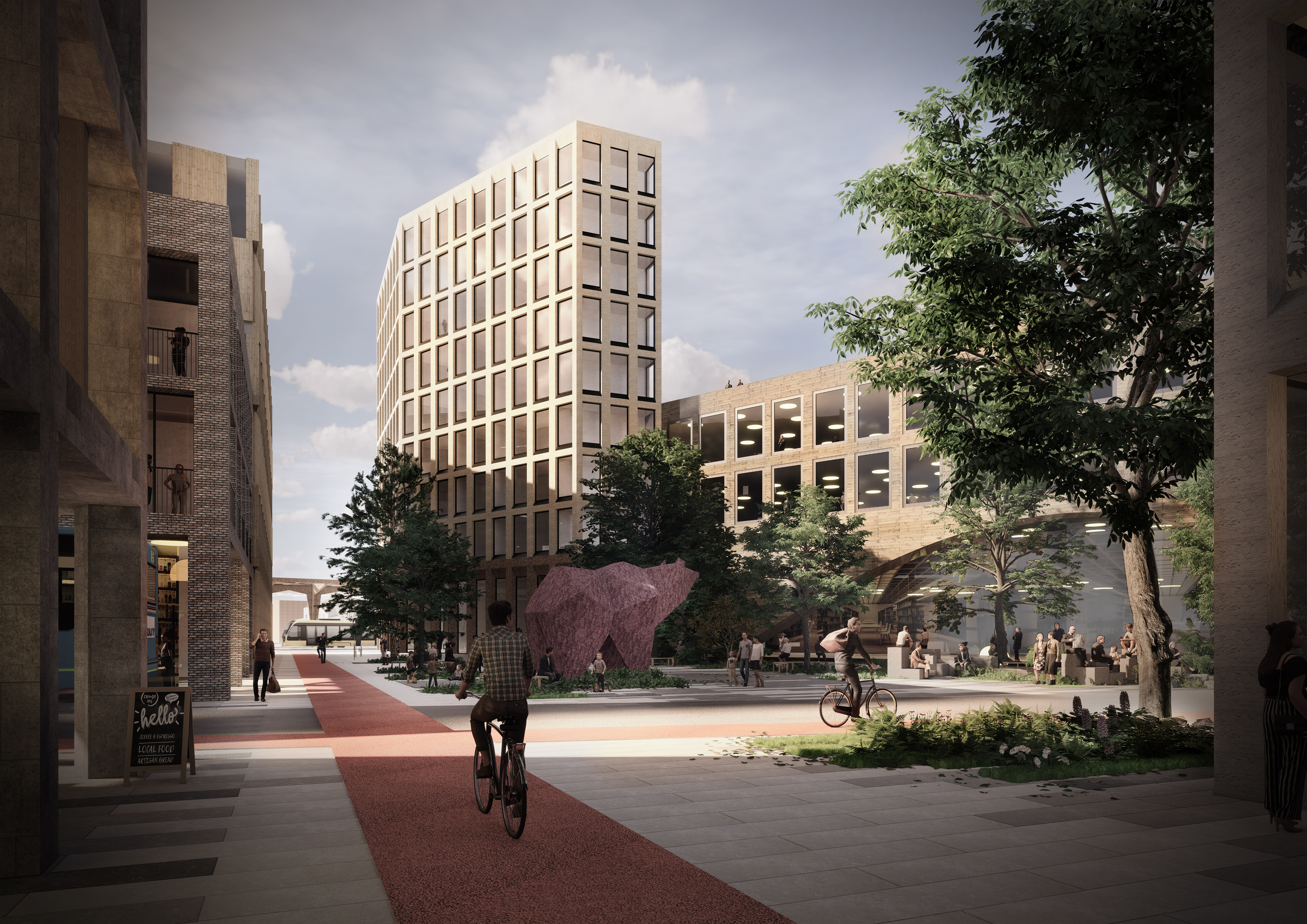
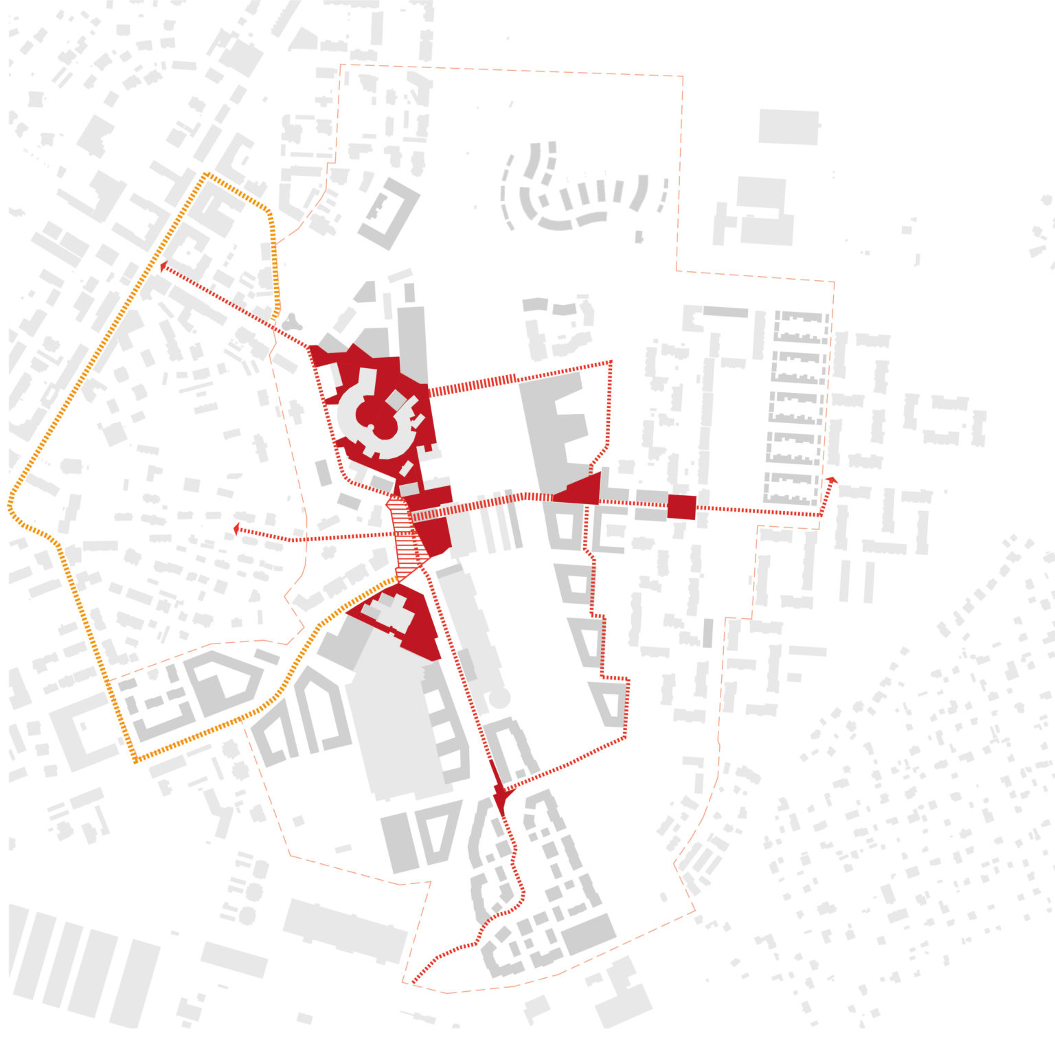
The Master Plan fosters community cohesion. The east and west connections across the railway have been enhanced, including improvement of the existing subway and overground connections. Careful consideration of the programming of land use increases interactions between communities living on both sides of the railway. A new multi-functional public service building on the east side incorporates a library, school, daycare, and elderly day facilities in one building, encouraging multi-generational social interaction.
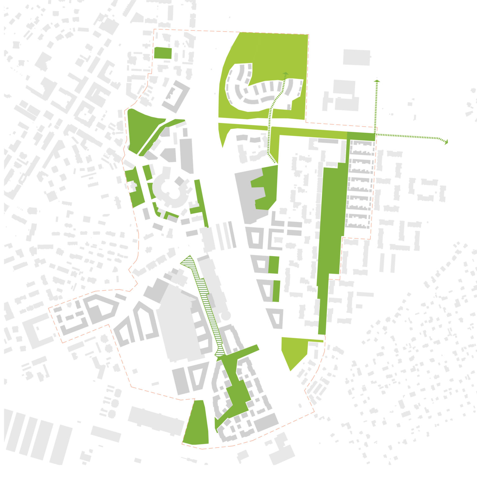
The design area is characterized by three main neighborhoods with distinct identities that are linked through the transport and blue and green networks to make a unified urban environment for Riihimäki.
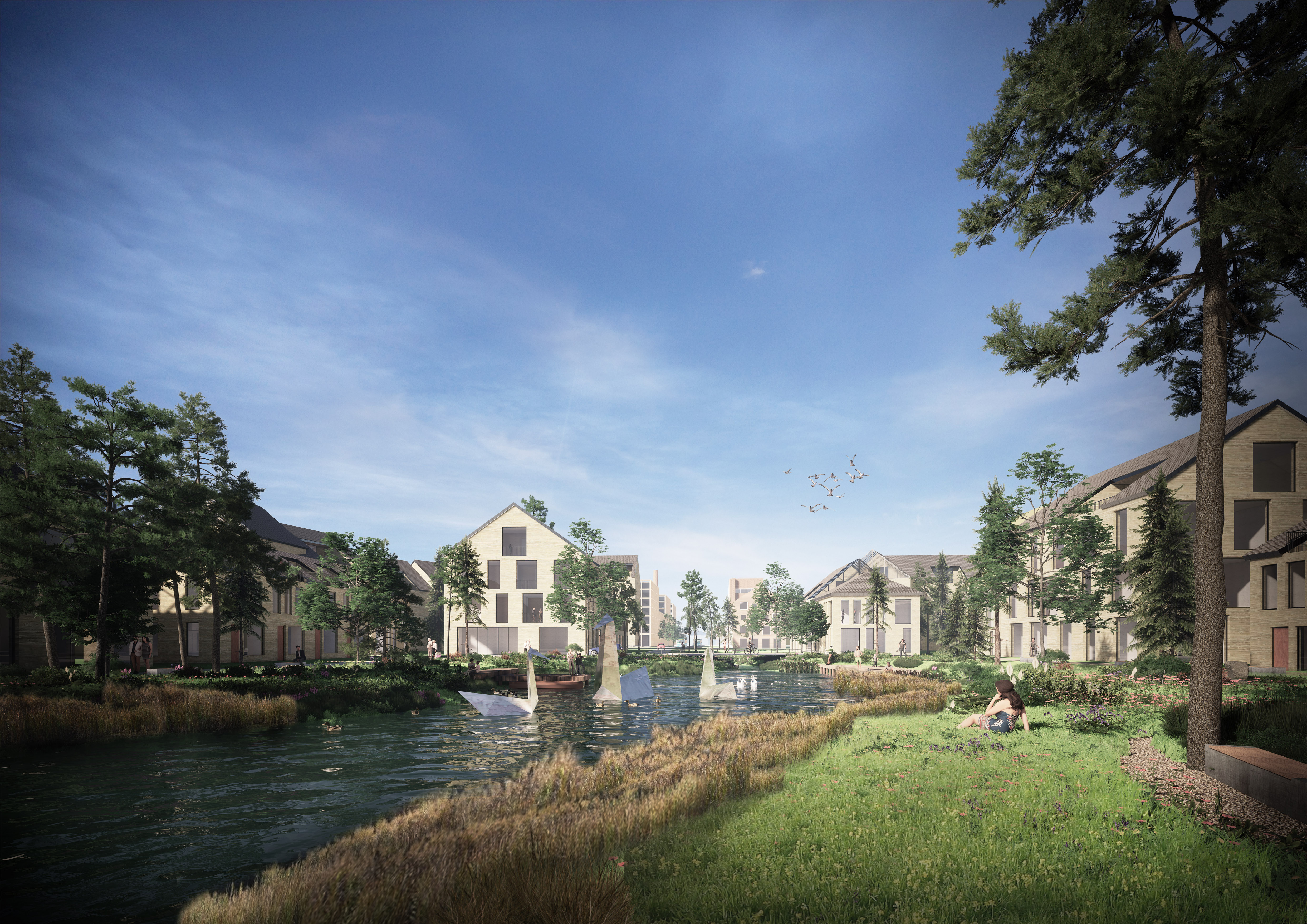
The eastern portion of the site is sensitive to flooding. The Master Plan provides sustainable amenity space for the community and mitigates potential flood risks through an innovative green and blue network of green streets, public parks, and a stormwater attenuation ponds incorporated into the city structure. Both pedestrian and habitat connectivity are enhanced through a pleasant green ring consisting of species-rich meadow planting, a linear park, and strategically placed pocket parks. The regionally significant Vantaanjoki river is integrated into the Master Plan in the form of a linear pedestrian route and flood pond that attenuates surface water run-off and fluvial flooding.
A key tenet of the blue infrastructure network is the organic management of stormwater. The central stormwater park in Peltosaari provides a large open green space for informal recreation while hosting a series of inter-connected stormwater attenuation ponds that increase the biodiversity of the area through supporting wetland biotopes. Adjacent to the school, a sports park hosts both school and public recreation facilities.
Biodiversity and habitat connectivity are enhanced through the green network of urban meadows, green streets, and green roofs. The high floristic content of the species mix encourages pollinators, supporting a wider ecosystem that extends beyond the design area and includes the local bat foraging habitat.
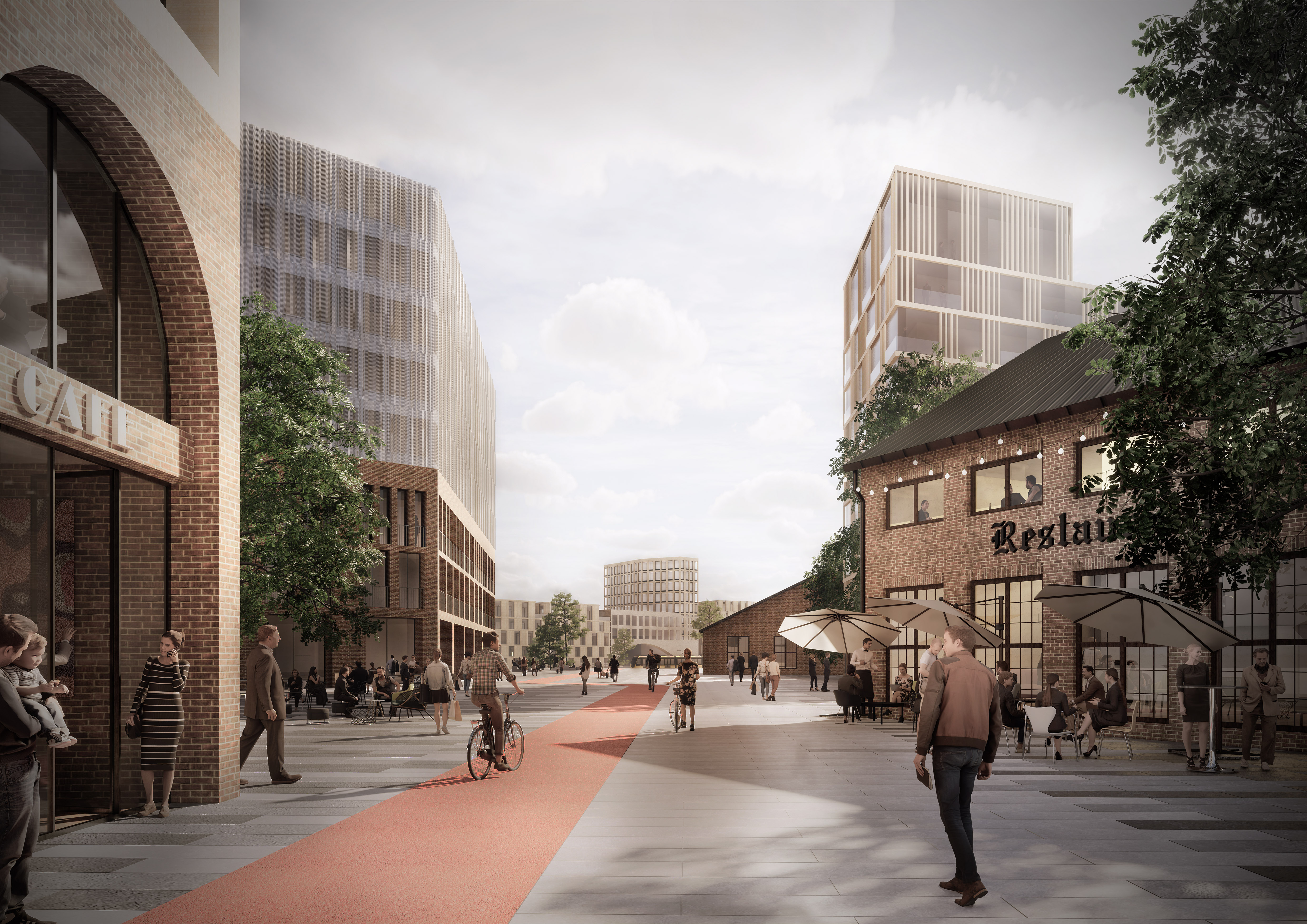
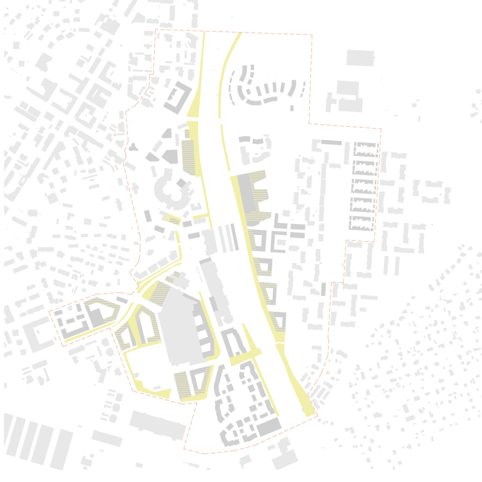
Cycling and walking are prioritized through pleasant human-scale environments, green streets, and a comprehensive cycle network that extends out of the design area and incorporates safe cycle parking at strategic locations. Sustainable transport is supported by the incorporation of the autonomous robot bus route that integrates the design area into the wider city.